


White, Jackson, Prairie & Woodruff Counties PUMA, Arkansas
About
Outline

Summary
| Unique Area Identifier | 192189 |
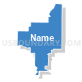
| Name | White, Jackson, Prairie & Woodruff Counties PUMA |
| State | Arkansas |
| Area (square miles) | 2,953.27 |
| Land Area (square miles) | 2,903.76 |
| Water Area (square miles) | 49.51 |
| % of Land Area | 98.32 |
| % of Water Area | 1.68 |
| Latitude of the Internal Point | 35.20835950 |
| Longtitude of the Internal Point | -91.46659020 |
Maps


Graphs
Select a template below for downloading or customizing gragh for White, Jackson, Prairie & Woodruff Counties PUMA, Arkansas


Neighbors
Neighoring Public Use Microdata Area (by Name) Neighboring Public Use Microdata Area on the Map
- Craighead (West), Greene, Randolph, Lawrence & Clay Counties PUMA, AR
- Faulkner & Lonoke Counties PUMA, AR
- Independence, Cleburne, Van Buren, Sharp, Izard, Stone & Fulton Counties PUMA, AR
- Jefferson, Grant & Arkansas (Northwest) Counties PUMA, AR
- Southeast Arkansas PUMA, AR
- St. Francis, Poinsett, Phillips, Cross, Lee & Monroe Counties PUMA, AR
Top 10 Neighboring County (by Population) Neighboring County on the Map
- Faulkner County, AR (113,237)
- Craighead County, AR (96,443)
- White County, AR (77,076)
- Lonoke County, AR (68,356)
- Independence County, AR (36,647)
- St. Francis County, AR (28,258)
- Cleburne County, AR (25,970)
- Poinsett County, AR (24,583)
- Arkansas County, AR (19,019)
- Jackson County, AR (17,997)
Top 10 Neighboring County Subdivision (by Population) Neighboring County Subdivision on the Map
- Gray township, White County, AR (25,007)
- Union township, White County, AR (9,421)
- Gum Pond township, Arkansas County, AR (9,220)
- Union township, Jackson County, AR (7,518)
- Harrison township, White County, AR (6,325)
- Cypress township, Faulkner County, AR (5,480)
- Magness township, Lonoke County, AR (5,084)
- Ward township, Lonoke County, AR (4,508)
- Bald Knob township, White County, AR (4,193)
- Gum Springs township, White County, AR (3,915)
Top 10 Neighboring Place (by Population) Neighboring Place on the Map
- Searcy city, AR (22,858)
- Newport city, AR (7,879)
- Beebe city, AR (7,315)
- Bald Knob city, AR (2,897)
- Augusta city, AR (2,199)
- Judsonia city, AR (2,019)
- Tuckerman city, AR (1,862)
- McCrory city, AR (1,729)
- Des Arc city, AR (1,717)
- Kensett city, AR (1,648)
Top 10 Neighboring Unified School District (by Population) Neighboring Unified School District on the Map
- Cabot Public Schools, AR (48,187)
- Searcy School District, AR (32,482)
- Forrest City School District, AR (23,630)
- Beebe School District, AR (17,431)
- Vilonia School District, AR (14,891)
- Wynne Public Schools, AR (14,318)
- Newport School District, AR (11,706)
- Stuttgart School District, AR (10,681)
- Lonoke School District, AR (9,959)
- Westside Consolidated School District, AR (9,112)
Top 10 Neighboring State Legislative District Lower Chamber (by Population) Neighboring State Legislative District Lower Chamber on the Map
- State House District 48, AR (41,391)
- State House District 47, AR (34,367)
- State House District 50, AR (32,318)
- State House District 49, AR (32,244)
- State House District 74, AR (30,962)
- State House District 59, AR (29,163)
- State House District 15, AR (29,068)
- State House District 72, AR (28,138)
- State House District 58, AR (27,318)
- State House District 73, AR (26,277)
Top 10 Neighboring State Legislative District Upper Chamber (by Population) Neighboring State Legislative District Upper Chamber on the Map
- State Senate District 30, AR (103,943)
- State Senate District 28, AR (91,744)
- State Senate District 14, AR (91,166)
- State Senate District 18, AR (85,656)
- State Senate District 29, AR (85,160)
- State Senate District 12, AR (83,956)
- State Senate District 11, AR (80,865)
- State Senate District 17, AR (71,695)
- State Senate District 15, AR (71,063)
- State Senate District 5, AR (63,334)
Top 10 Neighboring 111th Congressional District (by Population) Neighboring 111th Congressional District on the Map
Top 10 Neighboring Census Tract (by Population) Neighboring Census Tract on the Map
- Census Tract 712, White County, AR (9,546)
- Census Tract 709, White County, AR (8,248)
- Census Tract 201.04, Lonoke County, AR (7,068)
- Census Tract 710, White County, AR (7,016)
- Census Tract 201.01, Lonoke County, AR (6,749)
- Census Tract 711, White County, AR (6,561)
- Census Tract 708, White County, AR (6,364)
- Census Tract 705, White County, AR (6,300)
- Census Tract 302, Faulkner County, AR (6,052)
- Census Tract 704.01, White County, AR (5,684)
Top 10 Neighboring 5-Digit ZIP Code Tabulation Area (by Population) Neighboring 5-Digit ZIP Code Tabulation Area on the Map
- 72143, AR (35,169)
- 72396, AR (13,734)
- 72543, AR (12,535)
- 72012, AR (11,986)
- 72112, AR (11,467)
- 72160, AR (10,736)
- 72086, AR (10,727)
- 72173, AR (9,078)
- 72176, AR (8,141)
- 72081, AR (7,798)